
Kitesurfing in Adam's Bridge
Mannar · Sri Lanka
- Spot type Flat
- Rider level beginner
- Water Crystal Clear
- Beach Sand
- Crowd No people
- Tide effect None
Kitesurfing in Adam's Bridge: Conditions, Wind & Season
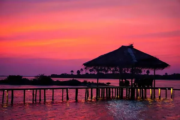
Adam's Bridge Kitespot is one of Sri Lanka's most remote and distinctive flat-water kitesurfing locations, situated near the western tip of Mannar Island in the country's Northern Province. The spot takes its name from Adam's Bridge, also known as Rama's Bridge, a remarkable chain of limestone shoals, sandbanks and small islands extending across the shallow waters of the Palk Strait toward India. This unusual coastal geography creates an extensive network of sheltered riding areas, with smooth water, shallow sandbanks and exposure to seasonal monsoon winds. Compared with the established kite centres of Kalpitiya, Adam's Bridge offers a more isolated environment, attracting riders who appreciate wide-open water, technical freestyle conditions and the opportunity to explore one of Sri Lanka's less developed kitesurfing regions.
The defining feature of Adam's Bridge is the series of natural sandbanks and shallow-water formations that divide the surrounding sea into sections with different riding conditions. On the sheltered side of these formations, the water can become exceptionally flat, sometimes approaching glassy conditions when the wind direction aligns with the sandbanks. More exposed sections develop small wind-driven chop or short waves, creating opportunities for freeriding over a livelier surface. The contrast between smooth water and open-sea conditions makes the area particularly interesting for riders who enjoy exploring different water textures within the same session. However, the precise location of the flattest water changes with wind direction, tidal stage and the configuration of the sandbanks.
Adam's Bridge benefits from Sri Lanka's two principal monsoon wind systems. The summer season generally extends from May through September, sometimes continuing into October, when the southwest monsoon produces the region's strongest and most persistent winds. During favourable periods, wind speeds can reach approximately 18 to 28 knots or more, creating powered conditions for freeriding, freestyle and controlled jumping. The winter season, generally from December through February or March, brings northeasterly winds that can also provide enjoyable kitesurfing opportunities. Winter winds are often lighter and more variable than the peak summer monsoon, but the different wind direction can open up alternative riding areas around the sandbanks. Both seasons offer potential, although the quality of each session depends on local wind exposure and weather conditions.
The open geography of the Palk Strait allows monsoon winds to travel across extensive stretches of water before reaching the riding area. This can produce relatively clean and consistent airflow away from land, particularly during established summer southwest monsoon conditions. However, the numerous sandbanks and small islands can create local differences in wind strength and direction, especially close to shore or behind raised sections of land. Riders should not assume that every part of Adam's Bridge receives identical wind conditions. The most suitable launching and riding zones vary between the southwest and northeast monsoon seasons, making local guidance particularly valuable for visitors unfamiliar with the area.
Flat-water freeriding is one of Adam's Bridge's greatest attractions. During suitable wind and tidal conditions, riders can enjoy long reaches across sheltered water with very little surface chop, allowing precise edging, smooth transitions and controlled carving manoeuvres. Intermediate kitesurfers can benefit from the relatively predictable surface when improving upwind performance or developing jumping technique. Experienced riders may find excellent conditions for technical freestyle and powered tricks, particularly where the sandbanks create smooth water on their sheltered side. However, the shallow seabed places important limits on jumping and hard landings. Riders should identify sufficiently deep sections before attempting advanced manoeuvres and avoid treating knee-deep water as a safe landing zone.
The water depth around Adam's Bridge varies considerably. Some areas are shallow enough to stand in, while nearby channels can become substantially deeper. At lower tide, sandbanks may become exposed, reducing the available riding area and creating obstacles that are difficult to identify from a distance. At higher tide, more of the shallow flats become submerged, potentially opening additional routes for freeriding. The combination of shallow sandbanks and deeper channels requires careful navigation, particularly when travelling away from established launching areas. Riders should check tide tables and seek local advice about the safest routes before exploring unfamiliar sections of the Palk Strait.
Tidal currents are another important consideration. Water moves through the channels and gaps between the sandbanks, and currents may become stronger where the flow is concentrated. These currents can affect upwind progress, equipment recovery and the ability to return to the intended launching point. Wind and current may also oppose one another, creating short chop in otherwise sheltered sections. Riders should avoid entering unfamiliar channels without understanding the tidal movement and should remain particularly cautious when the wind has an offshore component. The remote location means that a drifting rider or lost board can quickly become difficult to recover without appropriate support.
The seabed consists of a mixture of sand, shells and shallow marine sediment, with occasional harder limestone or rocky sections associated with the Adam's Bridge formations. Sharp shells, including large marine gastropod shells, may be present along the shoreline and in shallow water. These can cause cuts or puncture injuries, making protective footwear advisable when walking or launching in unfamiliar areas. The water can be clear enough to reveal some shallow features, but wind, sediment movement and changing light conditions may reduce visibility. Riders should avoid dragging boards or foil equipment across unknown seabed sections and remain alert to submerged obstacles, particularly near the edges of sandbanks.
Launching and landing conditions vary depending on the chosen access point. Some sandy sections provide relatively generous space for preparing equipment and launching, while others are narrow, uneven or surrounded by shallow water. The absence of dense urban development can make the area feel spacious, but remote launching locations introduce their own challenges. Riders must consider wind direction, shoreline shape, exposed shells and the availability of safe landing options before entering the water. Assisted launching may be useful during stronger winds, particularly when the beach is narrow or the wind is offshore. Local access restrictions and any environmental regulations affecting the sandbanks should be checked before preparing equipment.
Offshore wind conditions are among the most significant hazards at Adam's Bridge. Some of the flattest riding areas develop on the sheltered side of sandbanks, where the wind may blow away from the nearest accessible shoreline. Although these conditions can produce exceptionally smooth water, equipment failure or loss of board control may leave riders drifting toward deeper channels or remote sections of the Palk Strait. Independent sessions in offshore winds should not be attempted without reliable rescue arrangements. Some local operators may provide boat-supported kitesurfing excursions or rescue assistance, but availability and coverage must be confirmed directly before launching. Riders should never assume that a rescue boat is operating simply because the spot is associated with a nearby kite camp.
Adam's Bridge is best suited to intermediate and advanced kitesurfers who are comfortable with remote riding locations, shallow water and changing tidal conditions. The flat surface may appear ideal for beginners, but offshore winds, strong currents, sharp shells and limited access to immediate assistance can make independent learning hazardous. Beginner instruction should only take place under qualified supervision, in appropriately selected areas with reliable rescue support. Intermediate riders with solid upwind ability can enjoy the smooth water when conditions are suitable, while experienced riders may appreciate the opportunity to explore more demanding freestyle and freeride sections. Confidence in self-rescue and a clear understanding of the local geography are essential.
Hydrofoil kitesurfing is possible in selected deeper channels and open-water sections, but the extensive shallow sandbanks make careful route planning essential. Foil riders must identify sufficient depth before launching and remain alert to abrupt changes in the seabed. At lower tide, many of the smoothest sections may become too shallow for safe foiling. Wing-foiling may also be feasible in deeper areas when wind conditions are appropriate, although the same shallow-water and current-related hazards apply. The spot is primarily known for twin-tip flat-water riding rather than unrestricted foil cruising, and visitors using foil equipment should seek detailed local advice before entering the water.
The Adam's Bridge area forms part of an environmentally sensitive marine landscape, with shallow coastal habitats, sandbanks and birdlife that require protection. Sections of the surrounding region fall within protected areas, including Adam's Bridge Marine National Park, and recreational access may be regulated. Kitesurfers should verify current permissions, avoid disturbing wildlife and respect any restrictions affecting navigation, landing or activity on the sandbanks. The apparent remoteness of the location does not mean that unrestricted access is permitted. Responsible riding is particularly important in this fragile coastal environment, where repeated disturbance can affect sensitive habitats and protected species.
Sri Lanka's tropical climate provides warm air and water temperatures throughout the year, allowing most riders to kitesurf without heavy thermal protection. Boardshorts and lightweight protective clothing are generally sufficient, although a rash guard is advisable for protection against the strong tropical sun. During the summer monsoon, persistent winds can create noticeable wind chill after extended sessions, while winter conditions are often more moderate. Sun protection, hydration and suitable footwear are important during long days on the water. The remote setting also makes careful preparation essential, including carrying appropriate safety equipment and ensuring that communication and rescue arrangements are established before launching.
For riders searching for kitesurfing at Adam's Bridge, flat-water kite spots on Mannar Island or remote kitesurfing destinations in northern Sri Lanka, this extraordinary section of the Palk Strait offers a distinctive combination of shallow turquoise water, extensive sandbanks and seasonal monsoon winds. Its greatest strengths are the potential for exceptionally smooth freeriding conditions, technical freestyle progression and access to a relatively undeveloped coastal environment. However, offshore winds, tidal currents, sharp shells, shallow limestone formations and environmental restrictions require careful planning and local knowledge. For experienced riders who arrange suitable support and respect the protected surroundings, Adam's Bridge can provide one of Sri Lanka's most memorable flat-water kitesurfing experiences.
Something missing or out of date at this spot? Suggest a correction
Spot Gallery (7)


Adam's Bridge is best suited for
Spot profile
Travel spot
The typical kite travel destination, it is known for its great conditions, and kiters from around the world come here for their vacations.
Adventure spot
That dream place out of the normal touristic routes. Once you reach it, you feel in paradise, it can be anything extraordinary, a hidden gem, remote and fascinating.
Equipment
Given the warm tropical climate of Sri Lanka, a shorty wetsuit is typically sufficient. Kitesurfers should bring larger kites to make the most of the steady but moderate winds. Protective footwear is recommended due to the presence of sharp Murex shells on the beach.
Wind Conditions
Main wind directions at Adam's Bridge
Windy days per month in Adam's Bridge
Wind Speed Range
From 12 to 28 Knots
Suggested sizes
8 - 9 mt
10 - 11 mt
12 - 13 mt
14 mt and above
Forecast on Windy.com
Kitesurfing Safety & Local Rules at Adam's Bridge
The main hazards at Adam’s Bridge Kitespot come from sharp Murex shells scattered across the beach and shallow seabed. These shells can cause painful cuts to bare feet and may damage kite equipment if rigged directly on top of them. Protective water shoes are strongly recommended, and riders should inspect the sand before setting up their kites. The extensive knee-deep water also requires caution during jumps and hard landings, as striking the bottom can cause injuries.
Offshore winds are another important safety consideration, particularly in the flat-water areas behind the sandbanks. Although the shallow water provides some reassurance, it does not eliminate the risk of drifting away from shore, especially if a kite cannot be relaunched or a rider reaches deeper channels. Strong summer winds can also reach approximately 28 knots, making conditions demanding for inexperienced kiters. Always confirm that boat rescue support is available before riding in offshore conditions.
Adam’s Bridge is a remote and largely undeveloped area, so immediate assistance and emergency facilities may be limited. Shifting sandbanks, varying water depths and small waves on the exposed side require awareness when moving between riding areas. Avoid venturing far from the designated kite zone without local guidance, maintain safe distances from other riders and rely on organised rescue support rather than assuming that shallow water alone guarantees safety.
Location
Closest City
Mannar
How to get There
To reach Adam’s Bridge Kitespot, you can fly into Colombo Bandaranaike (CMB) Airport and then take an eight-hour drive to Mannar Island. For those seeking an alternative route, a train journey to Talaimannar station is possible, followed by a short tuk-tuk ride to the kitespot.
Access
Public
No-Wind Days: What to Do Around Adam's Bridge
Beyond kitesurfing, Adam's Bridge Kitespot offers an opportunity to discover one of Sri Lanka's most unusual and historically fascinating coastal regions. Located near the northwestern tip of Mannar Island, close to Talaimannar, the area is characterised by shallow turquoise waters, extensive sandbanks, quiet beaches and an extraordinary sense of remoteness. Unlike Sri Lanka's more developed beach destinations, Mannar attracts visitors interested in nature, history and cultural heritage rather than conventional resort entertainment. For a kitesurfing trip with non-kiters or a few windless days, the island offers several rewarding excursions, although facilities are limited and independent transport is particularly useful.
The most distinctive attraction is Adam's Bridge itself, also known as Rama Setu, a remarkable chain of limestone shoals and sandbanks extending between Mannar Island and India's Rameswaram Island. This natural formation separates parts of the Gulf of Mannar from the Palk Strait and holds great cultural and religious significance. In the Hindu epic Ramayana, the bridge is associated with the journey of Rama and his army to Lanka. Visitors can admire the coastal landscape near Talaimannar and, when permitted, join locally organised excursions towards accessible viewpoints. The sandbanks are environmentally sensitive, and access to offshore sections depends on regulations, weather and sea conditions. Walking across the entire formation is not a practical tourist activity.
The beaches around Talaimannar provide a beautiful setting for peaceful walks, photography and enjoying the island's remote atmosphere. Long stretches of sand, shallow coastal waters and views towards the distant shoals create a landscape quite different from Sri Lanka's tropical southern coastline. The area is particularly attractive during the early morning and late afternoon, when the changing light highlights the colours of the sea and surrounding sandbanks. Visitors can also discover traditional fishing communities and observe local boats along suitable sections of the shoreline. Swimming requires caution because tidal currents, shallow channels and changing seabed conditions can create hazards even where the water appears calm.
Talaimannar Lighthouse is another interesting landmark near the western end of Mannar Island. The lighthouse reflects the area's historical importance for navigation through the shallow waters separating Sri Lanka and India. Its coastal setting provides attractive opportunities for photography and appreciating the unusual geography of the region. Nearby, the historic Talaimannar Pier and railway terminus recall the period when ferry connections linked Sri Lanka with southern India. Although international passenger services have changed considerably over time, the remaining transport infrastructure provides an interesting glimpse into the island's maritime and railway heritage. Access to particular structures may be restricted, so visitors should respect signs and local regulations.
Mannar Island is also an important destination for birdwatching, particularly during the northern hemisphere winter when migratory birds arrive in Sri Lanka. The island's lagoons, salt flats, mudflats and shallow coastal waters provide feeding and resting habitats for numerous species, including flamingos, herons, egrets, terns and migratory shorebirds. The Vankalai Sanctuary, located near Mannar town, is internationally recognised as a wetland of ecological importance and forms part of the Ramsar network. Guided birdwatching excursions can be especially rewarding during migration periods, although sightings depend on season and local conditions. Visitors should maintain a respectful distance from wildlife and avoid disturbing sensitive wetland habitats. Information about the sanctuary is available through the Ramsar Convention on Wetlands.
A visit to Mannar town provides an opportunity to discover the island's multicultural heritage and everyday life. The town reflects a mixture of Tamil, Muslim and Christian traditions, visible in its places of worship, local markets and cuisine. Visitors can explore small shops, sample Sri Lankan and Tamil dishes or enjoy fresh seafood at local restaurants. Mannar is not a major tourist centre, so dining and entertainment options are relatively modest, but its authentic atmosphere is part of its appeal. The town also provides essential services, accommodation and transport connections for visitors staying near the more remote beaches of Talaimannar.
One of Mannar's most unusual attractions is its famous baobab tree, a remarkable specimen associated with the island's historical trading connections with Arabia and East Africa. The enormous trunk and distinctive shape make it one of the region's most recognisable natural landmarks. Although the tree is often described as being several centuries old, estimates of its exact age vary. Its presence offers an interesting reminder of Mannar's long history as a trading location along Indian Ocean maritime routes. The site is easily combined with a visit to Mannar town and is particularly appealing to photographers and travellers interested in unusual natural and historical landmarks.
Mannar Fort is another important historical attraction, situated near the causeway connecting Mannar Island with mainland Sri Lanka. Originally established by the Portuguese in the sixteenth century and subsequently modified during Dutch colonial rule, the fort reflects the strategic importance of controlling maritime trade and coastal access in the region. Its surviving walls and defensive structures provide a glimpse into several centuries of colonial history. Visitors can admire the fort's architecture and coastal setting, although access to particular sections may vary. The nearby waterfront also offers views of fishing activity and the shallow waters surrounding the island.
For travellers interested in religious and cultural heritage, the wider Mannar region contains several important pilgrimage sites. The Shrine of Our Lady of Madhu, located inland on the mainland, is one of Sri Lanka's most significant Catholic pilgrimage destinations. Set within a peaceful wooded environment, the shrine attracts visitors from different communities and offers an insight into the country's religious traditions. Reaching the sanctuary requires a longer excursion from Talaimannar, so transport should be arranged in advance. Visitors should dress respectfully and remain mindful of religious services and pilgrimage activities. The journey also provides an opportunity to see the rural landscapes of northwestern Sri Lanka beyond Mannar Island.
For anyone planning a kitesurfing holiday at Adam's Bridge and wondering what else there is to do, Mannar offers a distinctive combination of remote coastal scenery, birdwatching and cultural exploration. A no-wind day can include visiting the Adam's Bridge viewpoints, exploring Talaimannar's historic landmarks, photographing the famous baobab tree or discovering Mannar Fort and the town's traditional markets. Families and non-kiting partners can enjoy quiet beach walks and guided wildlife excursions, while travellers interested in history and religion can explore the island's multicultural heritage and nearby pilgrimage sites. Although organised entertainment and tourist facilities are limited, the extraordinary geography of Adam's Bridge and the peaceful atmosphere of Mannar make this one of Sri Lanka's most memorable destinations for travellers who appreciate nature, history and places beyond the usual tourist routes.
Local Kitesurfing Schools
Following you can find links to the page of the kitesurfing schools which operate on this spot. From there you can contact them through our form or directly via email or phone (if it was provided by them on the page).
Other kitesurfing spots near Adam's Bridge


All kitesurfing spots in Sri Lanka
Last updated: